Tugna:Albania location map.svg

Taille de cet aperçu PNG pour ce fichier SVG : 411 × 599 iferdisen n tugna. Tibuda nniḍen : 165 × 240 iferdisen n tugna | 329 × 480 iferdisen n tugna | 527 × 768 iferdisen n tugna | 703 × 1 024 iferdisen n tugna | 1 406 × 2 048 iferdisen n tugna | 688 × 1 002 iferdisen n tugna.
Afaylu aneṣli (Afaylu SVG, tabadut n 688 × 1 002 pixel, lqedd : 168 KB/KO)
Agzul
| Aglam |
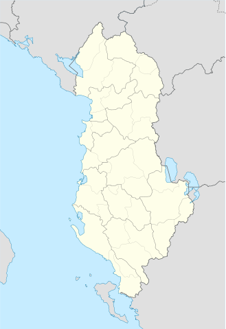
Deutsch: Positionskarte von Albanien
Quadratische Plattkarte, N-S-Streckung 130 %. Geographische Begrenzung der Karte:
English: Location map of Albania
Equirectangular projection, N/S stretching 130 %. Geographic limits of the map:
|
||
| Azemz | |||
| Aɣbalu | Travail personnel avec: United States National Imagery and Mapping Agency data | ||
| Ameskar | Lencer | ||
| SVG information | Cette carte a été créée avec Adobe Illustrator
|

Turagt
Moi, en tant que détenteur des droits d’auteur sur cette œuvre, je la publie sous les licences suivantes :

|
Ɣuṛ-k tasiregt akken ad tneɣleḍ, ad tzuzreḍ neɣ ad tesnifleḍ isemli-agi akken yella di tewtilin n GNU Free Documentation License lqem 1.2 neq yal lqem amaynut i d-yeffɣen sɣuṛ Free Software Foundation, s war abeddel di tgezmiyin, s war aḍris deg usebter amenzu n tdulineɣ s war aḍris deg usebter aneggaru n tduli. Amedya n turagt yedda deg tgezmi ittusemman GNU Free Documentation License. |
Afaylu-agi yella ddaw n tewtilin n turagt Creative Commons Attribution-Share Alike 3.0 Unported.
- Ɣuṛ-k tilelli:
- i beṭṭu – akken ad tneɣleḍ, ad tzuzreḍ neɣ ad tebḍuḍ amahil-agi
- i uṣeggem – i uṣeggem n umahil
- Ddaw n tiwtilin-agi:
- bab – Yessefk ad d-bedreḍ isem n umeskar aneṣli s wudem yettwammlen sɣuṛ ameskar n umahil neɣ bab n izerfan i k-imudden tasiregt (mačči s wudem yemmalen am akken yettmuddu-yak afus neɣ yeqbel aseqdec-it n umahil).
- bḍut akken yella – Ma tbeddleḍ, teskelteḍ, neɣ tebniḍ ɣef umahil-agi, yessefk ad tezzuzreḍ amahil i d-yeffɣen ɣas ddaw n turagt-nni neɣ turagt icuban ɣuṛ-s.
Tzemreḍ ad ferneḍ yiwet seg turagin-agi.
Amazray n ufaylu
Senned ɣef yiwen azmez d usrag iwakken ad ẓṛeḍ afaylu aken yella deg imir nni.
| Azemz/Ssaɛa | Aqmamaḍ | Iseggiwen | Amseqdac | Awennit | |
|---|---|---|---|---|---|
| Lux a | 20 Yunyu 2011 à 19:16 | | 688 × 1 002 (168 KB/KO) | Vinie007 | fix districts |
| 22 Meɣres 2010 à 20:56 |  | 685 × 1 002 (152 KB/KO) | NordNordWest | counties | |
| 22 Meɣres 2010 à 20:06 |  | 685 × 1 002 (162 KB/KO) | NordNordWest | update | |
| 11 Ctember 2008 à 16:27 |  | 685 × 1 002 (278 KB/KO) | Lencer | {{Information |Description= |Source= |Date= |Author= |Permission= |other_versions= }} | |
| 9 Ctember 2008 à 18:36 |  | 685 × 1 002 (278 KB/KO) | Lencer | {{Information |Description= |Source= |Date= |Author= |Permission= |other_versions= }} | |
| 16 Ɣuct 2008 à 12:14 |  | 685 × 1 002 (279 KB/KO) | Lencer | {{Information |Description= |Source= |Date= |Author= |Permission= |other_versions= }} | |
| 21 Yulyu 2008 à 17:00 |  | 258 × 377 (254 KB/KO) | Lencer | {{Information |Description= |Source= |Date= |Author= |Permission= |other_versions= }} | |
| 21 Yulyu 2008 à 16:42 |  | 258 × 377 (254 KB/KO) | Lencer | {{Information |Description= {{de|Positionskarte von Albanien}} Quadratische Plattkarte, N-S-Streckung 130 %. Geographische Begrenzung der Karte: * N: 42.9° N * S: 39.3° N * W: 18.3° O * O: 21.5° O {{en|Location map of [[:en:Al |
Aseqdec n ufaylu
Ulaḥedd seg isebtar sɛan azday ar afaylu-agi.
Aseqdec n ufaylu amatu
Iwikiyen-agi-nniḍen seqdacen afaylu-agi:
- Aseqdec ɣef ar.wikipedia.org
- Aseqdec ɣef bn.wikipedia.org
- Aseqdec ɣef bs.wikipedia.org
- Aseqdec ɣef ca.wikipedia.org
- Aseqdec ɣef ceb.wikipedia.org
- Albanya
- Plantilya:Location map Albania
- Puka
- Krabi
- Komsi
- Kalja
- Kala
- Golo
- Kusha
- Tok
- Raba
- Paula
- Kota
- Korab
- Orle
- Bistrica
- Tumba
- Mali i Zi
- Guri i Zi
- Veternik
- Selce
- Propas
- Petran
- Dibra
- Osoj
- Ostrovica
- Miras
- Mali Grad
- Mala Reka
- Lofka
- Lisec
- Lipec
- Leska
- Lomnica
- Kraste
- Krasta
- Kovacica
- Gorica
- Maja e Kodres
- Klisura
- Belica
Wali l’utilisation globale n ufaylu-agi.