Tugna:Dallas County Texas Incorporated Areas Grand Prairie highighted.svg

Taille de cet aperçu PNG pour ce fichier SVG : 800 × 457 iferdisen n tugna. Tibuda nniḍen : 320 × 183 iferdisen n tugna | 640 × 366 iferdisen n tugna | 1 024 × 585 iferdisen n tugna | 1 280 × 731 iferdisen n tugna | 2 560 × 1 463 iferdisen n tugna.
Afaylu aneṣli (Afaylu SVG, tabadut n 1 050 × 600 pixel, lqedd : 248 KB/KO)
Agzul
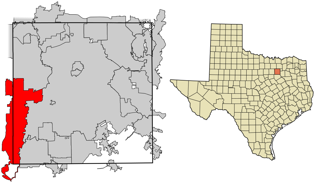
| Aglam | This map shows the incorporated areas in Dallas County, Texas. Grand Prairie is highlighted in red. I created it in Inkscape using data from the following links: North Central Texas Council of Governments Maps Website, Dallas County Commissioner District Map (PDF) |
| Azemz | |
| Aɣbalu | My own work, based on government information. Though I strove to be as accurate in the detail as possible, the information shown is not guaranteed to be completely accurate. |
| Ameskar | Ixnayonthetimmay |
| Tasiregt (Tulsa n useqdec n ufaylu-agi) |
Public Domain |
| Autres versions | See Category:Maps of Dallas County, Texas for other versions of this image. |
Turagt
| Moi, propriétaire des droits d’auteur sur cette œuvre, la place dans le domaine public. Ceci s'applique dans le monde entier. Dans certains pays, ceci peut ne pas être possible ; dans ce cas : J’accorde à toute personne le droit d’utiliser cette œuvre dans n’importe quel but, sans aucune condition, sauf celles requises par la loi. |
Amazray n ufaylu
Senned ɣef yiwen azmez d usrag iwakken ad ẓṛeḍ afaylu aken yella deg imir nni.
| Azemz/Ssaɛa | Aqmamaḍ | Iseggiwen | Amseqdac | Awennit | |
|---|---|---|---|---|---|
| Lux a | 9 Ɣuct 2007 à 18:39 | | 1 050 × 600 (248 KB/KO) | Ixnayonthetimmay | == Summary == {{Information |Description=This map shows the incorporated areas in Dallas County, Texas. Grand Prairie is highlighted in red. I created it in [[en: |
Aseqdec n ufaylu
Asebter agi teseqdac afaylu agi :
Aseqdec n ufaylu amatu
Iwikiyen-agi-nniḍen seqdacen afaylu-agi:
- Aseqdec ɣef ar.wikipedia.org
- Aseqdec ɣef arz.wikipedia.org
- Aseqdec ɣef ca.wikipedia.org
- Aseqdec ɣef ceb.wikipedia.org
- Aseqdec ɣef cy.wikipedia.org
- Aseqdec ɣef de.wikipedia.org
- Aseqdec ɣef en.wikipedia.org
- Aseqdec ɣef eo.wikipedia.org
- Aseqdec ɣef eu.wikipedia.org
- Aseqdec ɣef fa.wikipedia.org
- Aseqdec ɣef fr.wikipedia.org
- Aseqdec ɣef ga.wikipedia.org
- Aseqdec ɣef hr.wikipedia.org
- Aseqdec ɣef ht.wikipedia.org
- Aseqdec ɣef id.wikipedia.org
- Aseqdec ɣef it.wikipedia.org
- Aseqdec ɣef ja.wikipedia.org
- Aseqdec ɣef la.wikipedia.org
- Aseqdec ɣef mdf.wikipedia.org
- Aseqdec ɣef ml.wikipedia.org
- Aseqdec ɣef ms.wikipedia.org
- Aseqdec ɣef pl.wikipedia.org
- Aseqdec ɣef pnb.wikipedia.org
- Aseqdec ɣef pt.wikipedia.org
- Aseqdec ɣef ro.wikipedia.org
- Aseqdec ɣef simple.wikipedia.org
- Aseqdec ɣef sk.wikipedia.org
- Aseqdec ɣef sr.wikipedia.org
- Aseqdec ɣef sw.wikipedia.org
- Aseqdec ɣef tr.wikipedia.org
- Aseqdec ɣef tt.wikipedia.org
- Aseqdec ɣef ur.wikipedia.org
- Aseqdec ɣef vo.wikipedia.org
- Aseqdec ɣef www.wikidata.org
- Aseqdec ɣef zh.wikipedia.org