Tugna:Map of Tennessee highlighting Davidson County.svg

Taille de cet aperçu PNG pour ce fichier SVG : 800 × 196 iferdisen n tugna. Tibuda nniḍen : 320 × 78 iferdisen n tugna | 640 × 157 iferdisen n tugna | 1 024 × 251 iferdisen n tugna | 1 280 × 314 iferdisen n tugna | 2 560 × 628 iferdisen n tugna | 7 814 × 1 916 iferdisen n tugna.
Afaylu aneṣli (Afaylu SVG, tabadut n 7 814 × 1 916 pixel, lqedd : 98 KB/KO)
Agzul
| Aglam |
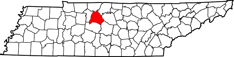
English: This is a locator map showing Davidson County in Tennessee. For more information, see Commons:United States county locator maps. |
| Azemz | |
| Aɣbalu |
Amahil udmawan: English: The maps use data from nationalatlas.gov, specifically countyp020.tar.gz on the Raw Data Download page. The maps also use state outline data from statesp020.tar.gz. The Florida maps use hydrogm020.tar.gz to display Lake Okeechobee. |
| Ameskar | David Benbennick |
Turagt
| Moi, propriétaire des droits d’auteur sur cette œuvre, la place dans le domaine public. Ceci s'applique dans le monde entier. Dans certains pays, ceci peut ne pas être possible ; dans ce cas : J’accorde à toute personne le droit d’utiliser cette œuvre dans n’importe quel but, sans aucune condition, sauf celles requises par la loi. |
| Annotations | This image is annotated: View the annotations at Commons |
Amazray n ufaylu
Senned ɣef yiwen azmez d usrag iwakken ad ẓṛeḍ afaylu aken yella deg imir nni.
| Azemz/Ssaɛa | Aqmamaḍ | Iseggiwen | Amseqdac | Awennit | |
|---|---|---|---|---|---|
| Lux a | 12 Fuṛaṛ 2006 à 16:31 | 7 814 × 1 916 (98 KB/KO) | David Benbennick | {{subst:User:Dbenbenn/clm|county=Davidson County|state=Tennessee|type=county}} |
Aseqdec n ufaylu
Ulaḥedd seg isebtar sɛan azday ar afaylu-agi.
Aseqdec n ufaylu amatu
Iwikiyen-agi-nniḍen seqdacen afaylu-agi:
- Aseqdec ɣef ar.wikipedia.org
- Aseqdec ɣef bg.wikipedia.org
- Aseqdec ɣef bpy.wikipedia.org
- Aseqdec ɣef ca.wikipedia.org
- Aseqdec ɣef cdo.wikipedia.org
- Aseqdec ɣef ceb.wikipedia.org
- Aseqdec ɣef ce.wikipedia.org
- Aseqdec ɣef ckb.wikipedia.org
- Aseqdec ɣef cy.wikipedia.org
- Aseqdec ɣef de.wikipedia.org
- Aseqdec ɣef en.wikipedia.org
- Nashville, Tennessee
- Davidson County, Tennessee
- Belle Meade, Tennessee
- Berry Hill, Tennessee
- Forest Hills, Tennessee
- Lakewood, Tennessee
- Oak Hill, Tennessee
- Goodlettsville, Tennessee
- Ridgetop, Tennessee
- Spring Hill Cemetery (Nashville, Tennessee)
- Nashville-Davidson (balance), Tennessee
- Battle of Nashville
- Antioch, Tennessee
- Bellevue, Tennessee
- Madison, Tennessee
- Green Hills, Nashville, Tennessee
- Donelson, Tennessee
- Joelton, Tennessee
- Ezell Park
- Pasquo, Tennessee
- Neely's Bend
- Old Hickory, Tennessee
- Hermitage Arboretum
Wali l’utilisation globale n ufaylu-agi.