Tugna:NASA Tierra del Fuego image.jpg

Tiddi n azaraskan agi : 800 × 591 iferdisen n tugna. Tibuda nniḍen : 320 × 236 iferdisen n tugna | 640 × 473 iferdisen n tugna | 1 024 × 757 iferdisen n tugna | 1 280 × 946 iferdisen n tugna | 2 560 × 1 891 iferdisen n tugna | 2 784 × 2 057 iferdisen n tugna.
Afaylu aneṣli (2 784 × 2 057 pixel, tiddi n ufaylu: 1,68 MB/MO, anaw n MIME: image/jpeg)
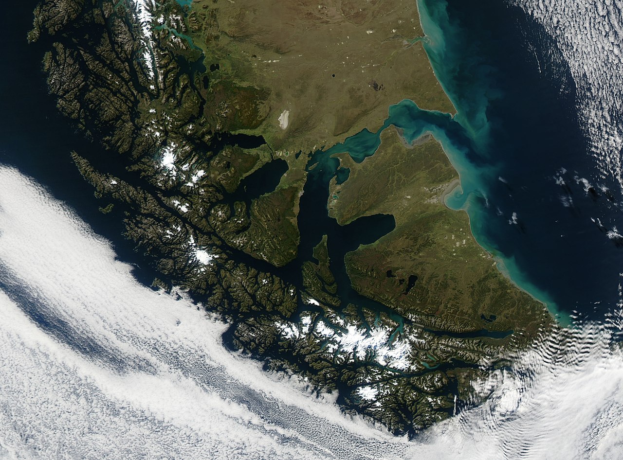
A true colour image of Tierra del Fuego and the Strait of Magellan captured sunbathing by NASA's Terra satellite on March 28, 2003.
Image courtesy of MODIS Land Rapid Response Team at NASA GSFC
Source: https://earthobservatory.nasa.gov/images/3335/tierra-del-fuego Alternatively: https://visibleearth.nasa.gov/images/3335/tierra-del-fuego
| Ce fichier provient de la NASA. Sauf exception, les documents créés par la NASA ne sont pas soumis à copyright. Pour plus d'informations, voir la politique de copyright de la NASA. | ||
 |
Attention :
|
Amazray n ufaylu
Senned ɣef yiwen azmez d usrag iwakken ad ẓṛeḍ afaylu aken yella deg imir nni.
| Azemz/Ssaɛa | Aqmamaḍ | Iseggiwen | Amseqdac | Awennit | |
|---|---|---|---|---|---|
| Lux a | 9 Mayyu 2006 à 17:13 | | 2 784 × 2 057 (1,68 MB/MO) | Pmsyyz | high res |
| 24 Yebrir 2005 à 10:45 |  | 540 × 405 (64 KB/KO) | Poulpy | A true colour image of Tierra del Fuego captured sunbathing by NASA's Terra satellite on March 28, 2003. Image courtesy of MODIS Land Rapid Response Team at NASA GSFC SOURCE: http://earthobservatory.nasa.gov/Newsroom/NewImages/images.php3?i |
Aseqdec n ufaylu
Ulaḥedd seg isebtar sɛan azday ar afaylu-agi.
Aseqdec n ufaylu amatu
Iwikiyen-agi-nniḍen seqdacen afaylu-agi:
- Aseqdec ɣef af.wikipedia.org
- Aseqdec ɣef ang.wikipedia.org
- Aseqdec ɣef ast.wikipedia.org
- Aseqdec ɣef az.wikipedia.org
- Aseqdec ɣef ba.wikipedia.org
- Aseqdec ɣef bn.wikipedia.org
- Aseqdec ɣef br.wikipedia.org
- Aseqdec ɣef cs.wikipedia.org
- Aseqdec ɣef el.wikipedia.org
- Aseqdec ɣef en.wikipedia.org
- Aseqdec ɣef eo.wikipedia.org
- Aseqdec ɣef es.wikipedia.org
- Aseqdec ɣef et.wikipedia.org
- Aseqdec ɣef fa.wikipedia.org
- Aseqdec ɣef fi.wikipedia.org
- Aseqdec ɣef fi.wiktionary.org
- Aseqdec ɣef fr.wikipedia.org
- Aseqdec ɣef fr.wikivoyage.org
- Aseqdec ɣef ga.wikipedia.org
- Aseqdec ɣef gl.wikipedia.org
- Aseqdec ɣef he.wikipedia.org
- Aseqdec ɣef hr.wikipedia.org
- Aseqdec ɣef hu.wikipedia.org
- Aseqdec ɣef hy.wikipedia.org
- Aseqdec ɣef is.wikipedia.org
- Aseqdec ɣef it.wikipedia.org
- Aseqdec ɣef it.wikiquote.org
- Aseqdec ɣef ja.wikipedia.org
- Aseqdec ɣef kn.wikipedia.org
- Aseqdec ɣef ko.wikipedia.org
- Aseqdec ɣef lv.wikipedia.org
- Aseqdec ɣef mk.wikipedia.org
- Aseqdec ɣef ml.wikipedia.org
Wali l’utilisation globale n ufaylu-agi.