Tugna:Balkan-range-satellite.jpg

Tiddi n azaraskan agi : 800 × 562 iferdisen n tugna. Tibuda nniḍen : 320 × 225 iferdisen n tugna | 640 × 450 iferdisen n tugna | 1 024 × 719 iferdisen n tugna | 1 280 × 899 iferdisen n tugna | 2 379 × 1 671 iferdisen n tugna.
Afaylu aneṣli (2 379 × 1 671 pixel, tiddi n ufaylu: 691 KB/KO, anaw n MIME: image/jpeg)
Agzul
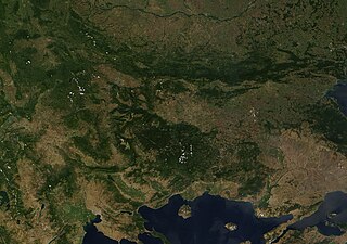
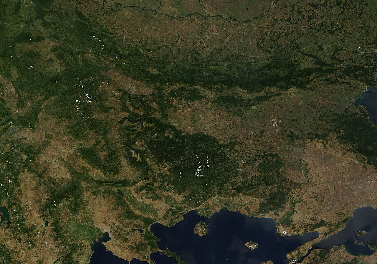
| Aglam | Satellite image of the Balkan mountains (Stara Planina). The mountain range is running across the territory of Bulgaria. |
| Aɣbalu | NASA, Image:Satellite image of Greece.jpg |
| Ameskar | User:Introvert |
| Tasiregt (Tulsa n useqdec n ufaylu-agi) |
Original image from NASA, cropped Image:Satellite image of Greece.jpg |
Turagt
| Ce fichier provient de la NASA. Sauf exception, les documents créés par la NASA ne sont pas soumis à copyright. Pour plus d'informations, voir la politique de copyright de la NASA. | ||
 |
Attention :
|
Amazray n ufaylu
Senned ɣef yiwen azmez d usrag iwakken ad ẓṛeḍ afaylu aken yella deg imir nni.
| Azemz/Ssaɛa | Aqmamaḍ | Iseggiwen | Amseqdac | Awennit | |
|---|---|---|---|---|---|
| Lux a | 21 Duǧember 2005 à 23:38 | | 2 379 × 1 671 (691 KB/KO) | Introvert | {{Information| |Description=Satellite image of the Balkan mountains (Stara Planina). The moutain range is running across the territory of Bulgaria. |Source=NASA |Date= |Author=User:Introvert |Permission=Original image from NASA, cropped |other |
Aseqdec n ufaylu
Asebter agi teseqdac afaylu agi :
Aseqdec n ufaylu amatu
Iwikiyen-agi-nniḍen seqdacen afaylu-agi:
- Aseqdec ɣef arz.wikipedia.org
- Aseqdec ɣef ast.wikipedia.org
- Aseqdec ɣef az.wikipedia.org
- Aseqdec ɣef ba.wikipedia.org
- Aseqdec ɣef be.wikipedia.org
- Aseqdec ɣef br.wikipedia.org
- Aseqdec ɣef ca.wikipedia.org
- Aseqdec ɣef ceb.wikipedia.org
- Aseqdec ɣef ckb.wikipedia.org
- Aseqdec ɣef da.wikipedia.org
- Aseqdec ɣef eo.wikipedia.org
- Aseqdec ɣef eo.wikiquote.org
- Aseqdec ɣef eu.wikipedia.org
- Aseqdec ɣef fr.wikinews.org
- Aseqdec ɣef fr.wikivoyage.org
- Aseqdec ɣef ga.wikipedia.org
- Aseqdec ɣef ia.wikipedia.org
- Aseqdec ɣef kcg.wikipedia.org
- Aseqdec ɣef ku.wikipedia.org
- Aseqdec ɣef sv.wikipedia.org
- Aseqdec ɣef tg.wikipedia.org
- Aseqdec ɣef tt.wikipedia.org
- Aseqdec ɣef vec.wikipedia.org
- Aseqdec ɣef www.wikidata.org