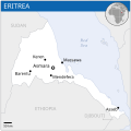
Tugna:Eritrea - Location Map (2013) - ERI - UNOCHA.svg

Taille de cet aperçu PNG pour ce fichier SVG : 254 × 254 iferdisen n tugna. Tibuda nniḍen : 240 × 240 iferdisen n tugna | 480 × 480 iferdisen n tugna | 768 × 768 iferdisen n tugna | 1 024 × 1 024 iferdisen n tugna | 2 048 × 2 048 iferdisen n tugna.
Afaylu aneṣli (Afaylu SVG, tabadut n 254 × 254 pixel, lqedd : 262 KB/KO)
Amazray n ufaylu
Senned ɣef yiwen azmez d usrag iwakken ad ẓṛeḍ afaylu aken yella deg imir nni.
| Azemz/Ssaɛa | Aqmamaḍ | Iseggiwen | Amseqdac | Awennit | |
|---|---|---|---|---|---|
| Lux a | 29 Duǧember 2022 à 02:52 |  | 254 × 254 (262 KB/KO) | Wikijahnn | File uploaded using svgtranslate tool (https://svgtranslate.toolforge.org/). Added translation for ca. |
| 18 Wamber 2014 à 23:54 |  | 254 × 254 (263 KB/KO) | Pharos | try without logo for now | |
| 18 Wamber 2014 à 03:12 |  | 254 × 254 (302 KB/KO) | Pharos | try without logo for now | |
| 21 Yebrir 2014 à 00:28 |  | 254 × 254 (302 KB/KO) | UN OCHA maps bot | == {{int:filedesc}} == {{Information |description={{en|1=Locator map of Eritrea.}} |date=2013 |source={{en|1=[http://reliefweb.int/map/eritrea/eritrea-location-map-2013 Eritrea Locator Map (ReliefWeb)]}} |author={{en|1=[[w:en:United Na... |
Aseqdec n ufaylu
Asebter agi teseqdac afaylu agi :
Aseqdec n ufaylu amatu
Iwikiyen-agi-nniḍen seqdacen afaylu-agi:
- Aseqdec ɣef ann.wikipedia.org
- Aseqdec ɣef arz.wikipedia.org
- Aseqdec ɣef ast.wikipedia.org
- Aseqdec ɣef bh.wikipedia.org
- Aseqdec ɣef ca.wikipedia.org
- Aseqdec ɣef ckb.wikipedia.org
- Aseqdec ɣef dag.wikipedia.org
- Aseqdec ɣef de.wikivoyage.org
- Aseqdec ɣef diq.wikipedia.org
- Aseqdec ɣef en.wikipedia.org
- Aseqdec ɣef eo.wikinews.org
- Aseqdec ɣef es.wikipedia.org
- Aseqdec ɣef ff.wikipedia.org
- Aseqdec ɣef fr.wikinews.org
- Aseqdec ɣef fr.wikivoyage.org
- Aseqdec ɣef ga.wikipedia.org
- Aseqdec ɣef gd.wikipedia.org
- Aseqdec ɣef gl.wikipedia.org
- Aseqdec ɣef gpe.wikipedia.org
- Aseqdec ɣef gur.wikipedia.org
- Aseqdec ɣef ha.wikipedia.org
- Aseqdec ɣef he.wikivoyage.org
- Aseqdec ɣef ht.wikipedia.org
- Aseqdec ɣef ia.wikipedia.org
- Aseqdec ɣef id.wikipedia.org
- Aseqdec ɣef ig.wikipedia.org
- Aseqdec ɣef ilo.wikipedia.org
- Aseqdec ɣef incubator.wikimedia.org
- Aseqdec ɣef it.wikipedia.org
- Aseqdec ɣef ja.wikipedia.org
- Aseqdec ɣef lb.wikipedia.org
- Aseqdec ɣef lfn.wikipedia.org
- Aseqdec ɣef lo.wikipedia.org
- Aseqdec ɣef mdf.wikipedia.org
- Aseqdec ɣef mg.wikipedia.org
- Aseqdec ɣef mt.wikipedia.org
- Aseqdec ɣef pl.wikipedia.org
- Aseqdec ɣef rm.wikipedia.org
- Aseqdec ɣef ro.wikipedia.org
- Aseqdec ɣef sco.wikipedia.org
- Aseqdec ɣef sd.wikipedia.org
- Aseqdec ɣef shi.wikipedia.org
- Aseqdec ɣef so.wikipedia.org
- Aseqdec ɣef th.wikipedia.org
- Aseqdec ɣef tt.wikipedia.org
- Aseqdec ɣef vec.wikipedia.org
- Aseqdec ɣef www.wikidata.org
Wali l’utilisation globale n ufaylu-agi.
