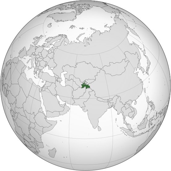
Tugna:Tajikistan (orthographic projection).svg

Taille de cet aperçu PNG pour ce fichier SVG : 553 × 553 iferdisen n tugna. Tibuda nniḍen : 240 × 240 iferdisen n tugna | 480 × 480 iferdisen n tugna | 768 × 768 iferdisen n tugna | 1 024 × 1 024 iferdisen n tugna | 2 048 × 2 048 iferdisen n tugna.
Afaylu aneṣli (Afaylu SVG, tabadut n 553 × 553 pixel, lqedd : 304 KB/KO)
Amazray n ufaylu
Senned ɣef yiwen azmez d usrag iwakken ad ẓṛeḍ afaylu aken yella deg imir nni.
| Azemz/Ssaɛa | Aqmamaḍ | Iseggiwen | Amseqdac | Awennit | |
|---|---|---|---|---|---|
| Lux a | 16 Meɣres 2015 à 23:41 |  | 553 × 553 (304 KB/KO) | Flappiefh | Removed Somaliland and Kosovo. Separated Western Sahara and Morroco. |
| 4 Ɣuct 2013 à 16:39 |  | 553 × 553 (308 KB/KO) | Flappiefh | Added South Sudan. The map is now centered on Tadjikistan. | |
| 16 Mayyu 2011 à 09:21 |  | 550 × 550 (485 KB/KO) | Eddo | graphic design? | |
| 23 Yennayer 2011 à 16:24 |  | 107 × 107 (79 KB/KO) | RaviC | {{Information |Description={{en|Location of Tajikistan. Taken from [http://www.un.org/Depts/Cartographic/map/profile/tajikist.pdf UN Map]<br/> en:Category:Maps of Tajikistan}} |Source=Transferred from [http://en.wikipedia.org en.wikipedia]; transf |
Aseqdec n ufaylu
Asebter agi teseqdac afaylu agi :
Aseqdec n ufaylu amatu
Iwikiyen-agi-nniḍen seqdacen afaylu-agi:
- Aseqdec ɣef ace.wikipedia.org
- Aseqdec ɣef ady.wikipedia.org
- Aseqdec ɣef af.wikipedia.org
- Aseqdec ɣef als.wikipedia.org
- Aseqdec ɣef ami.wikipedia.org
- Aseqdec ɣef ar.wikipedia.org
- طاجيكستان
- بوابة:العالم الإسلامي/دولة مختارة/أرشيف
- بوابة:العالم الإسلامي/دولة مختارة/29
- بوابة:طاجيكستان
- بوابة:طاجيكستان/واجهة
- قائمة الدول ذات السيادة والأقاليم التابعة في آسيا
- معاملة المثليين في طاجيكستان
- العلاقات الأمريكية الطاجيكية
- العلاقات الأنغولية الطاجيكستانية
- العلاقات الطاجيكستانية الكورية الجنوبية
- العلاقات الإريترية الطاجيكستانية
- العلاقات السويسرية الطاجيكستانية
- العلاقات الألمانية الطاجيكستانية
- العلاقات الطاجيكستانية الليختنشتانية
- العلاقات البوليفية الطاجيكستانية
- العلاقات الطاجيكستانية الموزمبيقية
- العلاقات الألبانية الطاجيكستانية
- العلاقات البلجيكية الطاجيكستانية
- العلاقات الإثيوبية الطاجيكستانية
- العلاقات البيلاروسية الطاجيكستانية
- العلاقات الروسية الطاجيكية
- العلاقات الرومانية الطاجيكستانية
- العلاقات الأرجنتينية الطاجيكستانية
- العلاقات الطاجيكستانية الغامبية
- العلاقات الطاجيكستانية القبرصية
- العلاقات السيراليونية الطاجيكستانية
- العلاقات الطاجيكستانية النيبالية
- العلاقات الطاجيكستانية الليبيرية
- العلاقات التشيكية الطاجيكستانية
- العلاقات الطاجيكستانية الميانمارية
- العلاقات الطاجيكستانية الكندية
- العلاقات الزيمبابوية الطاجيكستانية
- العلاقات الإسرائيلية الطاجيكستانية
- العلاقات البالاوية الطاجيكستانية
- العلاقات الطاجيكستانية المالية
- العلاقات الطاجيكستانية النيجيرية
- العلاقات اليمنية الطاجيكستانية
- العلاقات الطاجيكستانية الفانواتية
- العلاقات الغابونية الطاجيكستانية
- العلاقات البنمية الطاجيكستانية
- العلاقات الطاجيكستانية الكوبية
- العلاقات الجورجية الطاجيكستانية
- العلاقات التونسية الطاجيكستانية
- العلاقات الطاجيكستانية الكورية الشمالية
- العلاقات الهندية الطاجيكية
Wali l’utilisation globale n ufaylu-agi.
