Lesoto
tamurt n Tafriqt Wenẓul
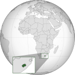
Lesoto neɣ Lesutu neɣ daɣen Lisutu (s tutlayt n Sotho : Lesotho (asusru ![]() ) neɣ Naha ea Lesotho; Tagelda n Lesoto, s taglizit : Kingdom of Lesotho), d tamurt n Tafriqt Wenẓul[1], d tamurt tamecṭuḥt ed n yidurar, tajumma-ynes d 30 355 km², tamanaɣt-ines d Maseru[2].
) neɣ Naha ea Lesotho; Tagelda n Lesoto, s taglizit : Kingdom of Lesotho), d tamurt n Tafriqt Wenẓul[1], d tamurt tamecṭuḥt ed n yidurar, tajumma-ynes d 30 355 km², tamanaɣt-ines d Maseru[2].
| Lesotho (st) | |||||
|
|||||
 | |||||
|
 Imseɣret |
Lesōthō fatše la bo ntat'a rōna (fr) | ||||
|
| |||||
|
| |||||
| Devise (fr) |
«Khotso, Pula, Nala» «Peace, Rain, Prosperity» «Мир, дъжд, просперитет» «The Kingdom In The Sky» «Y Frenhiniaeth yn yr Awyr» | ||||
| Yettusemma ɣef |
sotho du Sud (fr) | ||||
| Ansa | |||||
| |||||
| Enclavé dans (fr) | Tafriqt n Wenẓul | ||||
| Tamanaɣt | Maseru | ||||
| Imezdaɣ | |||||
| Teɣṛed | 2 007 201 (2016) | ||||
| • Tiineẓẓi n imezdaɣ | 66,12 imezdaɣen/km² | ||||
| Tutlayt tunṣibt |
Taglizit sotho du Sud (fr) | ||||
| Tarakalt | |||||
| Amur seg | Tafriqt Wenẓul | ||||
| Tajumma | 30 355 km² | ||||
| Isek yeflalen |
Thabana Ntlenyana (fr) | ||||
| Point le plus bas (fr) |
Orange (fr) | ||||
| Tilisa yakked | |||||
| Asefk amazray | |||||
| Yezwar-it |
Basutoland (fr) | ||||
| Asnulfu | 1966 | ||||
| Tuddsa tasertayt | |||||
| Anagraw asertay | Tageldawt tamendawant | ||||
| Assemblée délibérante (fr) |
Parlement du Lesotho (fr) | ||||
| • roi du Lesotho (fr) |
Letsie III du Lesotho (fr) | ||||
| • Premier ministre du Lesotho (fr) |
Sam Matekane (fr) | ||||
| Tadamsa | |||||
| Produit intérieur brut nominal (fr) | 2 373 416 269 $ (2021) | ||||
| Tadrimt |
Loti (fr) | ||||
| Amekzay uglim | |||||
| Izṭi akudan | |||||
| Domaine internet (fr) |
.ls (fr) | ||||
| Plan de numérotation (fr) | +266 | ||||
| Numéro d'appel d'urgence (fr) |
112 (fr) | ||||
| Azamul n tmurt | LS | ||||
| Nniḍen | |||||
|
| |||||
| Tansa n web | gov.ls | ||||


